Mapping lava tube caves with LiDAR
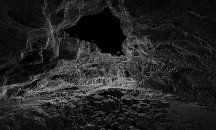 3D LiDAR image of the entrance of Maze Cave north of Shoshone, ID. A wooden pallet can be seen towards the back for scale. The black patch at the top of the image is a hole in the ceiling that serves as the cave entrance.
In 2015, I worked for the Bureau of Land Management in Shoshone, Idaho, as part of the Geological Society of America’s GeoCorps program. Most of my time was spent driving around the desert, dodging rattlesnakes and exploring lava tube caves. In collaboration with researchers from Idaho State University, we used a tripod-mounted LiDAR system to map the interior of several caves.
The BLM was interested in detailed cave maps for practical reasons – in case of a rescue, for example – as well as for basic research purposes. Precise cross-sections of lava tubes can be used to infer the velocity and viscocity of lava that once flowed through the caves, while a time series of LiDAR scans can be used to better understand cave wall deformation and cave collapse.
Babak Ghazi
PhD student
Babak completed his graduate studies in Earth and Environmental Related Studies at Nicolaus Copernicus University in Toruń, Poland, in 2024. He is currently a researcher in the UNLV Geoscience Department, with a focus on Hydrology. His research focuses on analyzing groundwater-surface water interactions by integrating climate, land use, and geological data, particularly for managed aquifer recharge implementation.